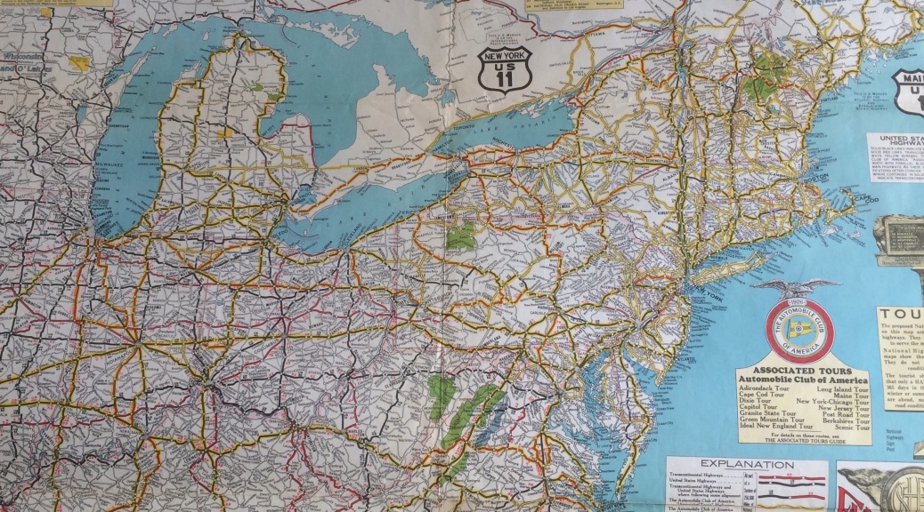
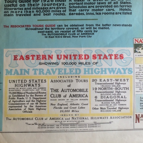
Welcome back to the future in antique maps, prints and ephemera, strap on your seat belts and goggles, this month we drive into early motor touring maps of the U. S. Interstate Highway System. And explore the beginning of the Lincoln Highway with D. Eisenhower. In the early 1900’s demand for and use of automobiles exploded in the United States with the success of Ford, Packard and other auto makers. Unfortunately, good roads and maps were hard to find and few people had ever crossed the country in an automobile. In 1911, Charles Henry Davis founded the National Highways Association with the famous slogan: “Good Roads Everywhere.” The map above and shown again below, is one of the largest “Good Roads Everywhere” maps for the Eastern Seaboard, dated 1926, this map is really a time capsule that also displays ephemera from the time.

Automobile touring maps have wonderful color and character and are now rare, close inspection of the upper right corner above shows a fun slogan, “A Paved United States in our Day.” Sometimes called “Motoring Tour Maps,” and beginning around 1912, these maps were available in Europe as well at the U.S. as lithographed “ephemeral publications” and were often created by individuals, associations, tourist organizations and sponsored by hotels and other businesses along the route. As ephemeral publications, they provide important insights into activities and perceptions of the period, in addition to a record of the roads at that time.
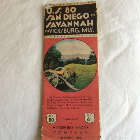
The map above sponsored by the Vicksburg Bridge Company (circa 1940) is a great example of an early auto touring map, published by the Mid West Map Company of Aurora Missouri, inside are wonderful depictions of what you might see along the route.


Above is a panoramic fold out of the Vicksburg National Military Park and Vicinity, below are more scenes from this touring map, “cotton picking now, and a southern plantation.”


Charles Davis was an innovative visionary, raised in Philadelphia as a Quaker he became a civil engineer and resided in the famous house of Seven Chimneys, of Yarmouth Massachusetts (probably haunted.) He was also president of the American Road Machine Company and built the first high-speed street railway from Washington D. C. to Mount Vernon, VA. Davis a great believer in autos, leased his coal holdings to Henry Ford and received a royalty on each Ford car produced. It was then his vision of a National Highway Network emerged with an ambitious early initiative, building out a National Highway System that would serve 66% of the U.S. population, consisting of 100, 000 miles of:
- 6 Main Great Highways
- 13 Trunk Highways
- 40 Link Highways

Davis believed that the National Highway System should be built by the federal government and a $10,000 a mile the cost would be around $500M. He proposed the creation of a National Highway Commission to study and report to Congress, established headquarters in Washington D. C. and as President brought in the rich Coleman Du Pont as Chairman. By 1913 he had built an office on his estate in Yarmouth, had 40 employees and began working with State highway officials to develop up-to-date maps of every state.
In late 1916-1919, Davis’s organization was kind of super-ceded by AAA, and other organizations, such as the American Highway Association, which supported the creation of the Federal Highway Commission. It wasn’t until the Federal Highway Act of 1921 that any federal aid would go to building a national system of highways. By that time Davis had been dismissed by the highway community, primarily because none of the highways he had proposed were built, and it was felt that his organization had created only ideas and content. There is an old saying about pioneers and innovators, sometimes they get arrows in their backs!
The First Transcontinental Motor Train
At the end of WWI truck convoys of troops played a strategic and major role in the mass movement of troops in France and the military took notice. But it wasn’t until 1911 that the American Army wrote the specifications for an Army truck, thus began the long relationship between Detroit and the military.
On July 7, 1919 a convoy of 81 military vehicles and one shiny white Packard carrying convoy pilot Henry Ostermann, began an epic journey from the White House traveling 3, 250 miles to San Francisco. Known as the “First Transcontinental Motor Train,” it was the first step in the building of the Lincoln Highway and one of its participants was Dwight D. Eisenhower. Sold as a public relations and recruitment drive for the Army, the expedition encountered some the the worst roads in America through mountains, deserts and mud as they made their way West. They also had a film crew in tow and filmed events along the way, like the photos below.
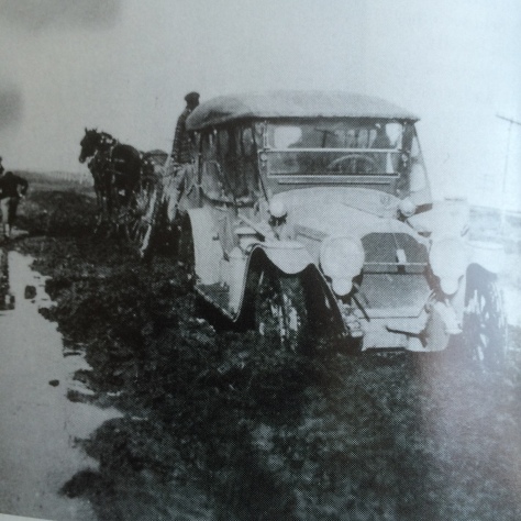
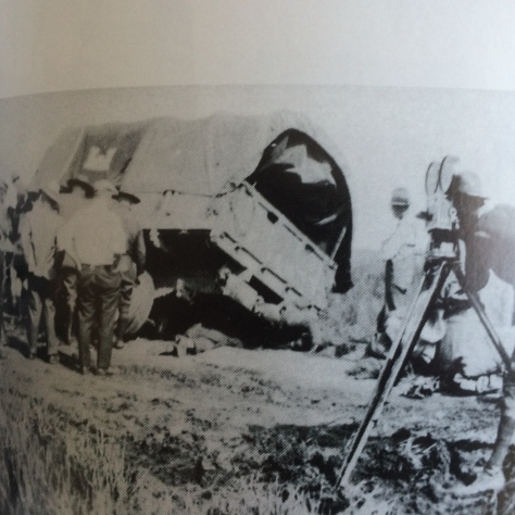
At the time American roads were terrible, average speeds were 6 miles per hour and there was no organized network of connected highways in any state of the union. On September 9, 1919 nearly eight weeks after leaving Washington, the convoy completed their mission. Even Eisenhower had his doubts and stated, “We were not sure if it could be accomplished at all.” Thirty seven years later, Eisenhower signed into law the biggest civil engineering project in the world, the building of the U.S. Interstate Highway System.

And again as with any journey there is an end, and more importantly, if you haven’t driven across the U.S you need to!. I hope you have enjoyed this week’s “Journey’s into History,” recommended reading this week, American Road, by Pete Davies, Henry Halt and Company, New York, 2002. The photos above came from his excellent book: American Road, The Story of an Epic Transcontinental Journey at the Dawn of the Motor Age!
We Have a Great Auto Page Also!
Enter code B14 in the comments section for a 10% discount on any print or map!
